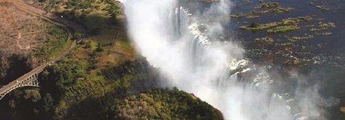
Zambia Chapter

Contact Information
Chapter Lead: Kaumba Chaka Harold
Email: [email protected]
Chapter Officials:
- Sesele Sokotela
- Chabala Chiyaze
- Grace Mulenga
- Evaristo Simusokwe
Description
MISSION
To bring up and promote the application of Geographical Information Sciences (GIS) and Technologies in sustainable utilization of Natural Resources in Zambia
AIM
To create a network and an association for conservationists applying GIS technology as a management tool.
OBJECTIVES
- To provide a forum for networking and exchange of ideas and technologies in GIS/Geography for the Natural Resources and Conservation GIS community.
- Promote use of GIS/Geography for the conservation and management of Natural Resources in Zambia.
- Develop a collective strategy for members' needs in GIS application and use.
- Showcase success of GIS as a management tool for conservation and management of Natural Resources.
- Publish a conservation GIS newsletter.
- Promote collaborative conservation and Natural Resources initiatives.
- Uphold best practices in use of GIS for conservation and management of Natural Resources and mitigation of environmental degradation.
- To promote, conduct awareness campaigns and advocacy on Climate Change.
- Create a link between Conservation GIS users in Zambia with the outside world.
MEMBERSHIP CATEGORIES
Student Member
- Primary School Member
- Secondary School Member
- Higher Education Member
Standard Member
Corporate Member
Life Member
MILESTONES
2009
- Friends Come together to form the Zambia SCGIS Executive Committee (EC); Constitution formulated
2010
- Application for Registration with Registrar of Societies Completed
- One member awarded Scholarship to attend SCGIS International Conference, ESRI, USA
2011
- 25 August 2011 Zambia SCGIS Registered with Certificate of Registration provided by Registrar of Societies in Zambia
Jan 2012
- Executive Committee (EC) Planning for the Launch
Mar 2012
- EC selects two member candidates for Scholarship Award to attend SCGIS International Conference, USA in July.
- Launch Committee Appointed to spearhead the Launch Programme
- Training Team for GPS/GIS Basic Course for members and the general public formed and developing a training manual booklet (7 members trained)
July 2012
- One member awarded SCGIS International Scholarship to attend SCGIS International Conference, ESRI, USA
- One member awarded SCGIS International Scholarship to attend SCGIS International Conference, ESRI, USA
Mar 2013
- SCGIS Training of Members from Corporate Institutions (9 members trained)
July 2013
- One member awarded Scholarship to attend SCGIS International Conference, ESRI, USA
Aug 2013
- Extra Ordinary General Meeting
|

